

Context
Tropical and subtropical deforestation and degradation are a major source of carbon emission, a main driver of global biodiversity loss, and results in the fundamental restructuring of ecosystem functioning and thus ecosystem service provisioning.
Understanding forest dynamics is thus of great international concern, and remote sensing is the foundation for monitoring these changes. Conventional methods to interpret remote sensing data often rely on mapping conversions among discrete land cover classes and do not capture the strong heterogeneity in vegetation types, as well as the fine-scale spatial complexity of forest disturbance.
As a result, we are lacking tools capable of monitoring gradual changes in forest structure, biomass and functioning that are the result of forest degradation. Moreover, regarding forest change mapping, moist tropical forests have been in the focus, whereas dryland woodlands or forests, (comprising forests, shrublands and savannas) remain under-researched – although they have recently emerged as global hotspots of forest degradation.
Objectives
The central objective of our research team is to integrate multi-source remotely sensed data, field observations and land surface models to enhance our insights in ecosystem degradation in dryland forests.
Our specific research questions are the following:
- How can woodland degradation be estimated using different remote sensing methods?
- Can land surface models be used to assess soil degradation?
- How do land use actors and land use policies affect and are affected by degradation?
Study site
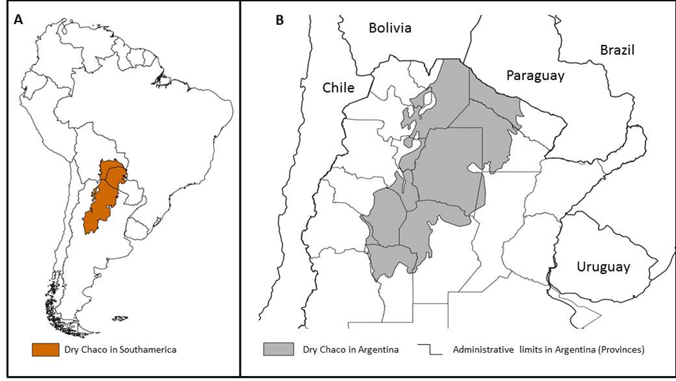
Figure 1: Study area map showing the entire Dry Chaco (A) and the Argentine section of Dry Chaco (B)
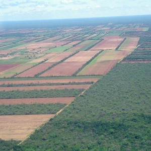
The research is based on the Argentina Dry Chaco. Subtropical and temperate dry forests and savannas of Argentina, Bolivia and Paraguay, called the Gran Chaco, represent the largest continuous woody ecosystem of Latin America outside of the Amazon. An active agricultural frontier is moving forward with soybean and planted pastures expanding rapidly. The Dry Chaco is a subregion of the Gran Chaco (Figure 1); and includes both a dry (in the west) and wet (in the east) component. The region is characterised by a semi-arid and highly seasonal climate, with a dry season lasting from May to September, and a warm, wet season from October to April. The difference between mean annual precipitation and potential evapotranspiration results in severe moisture deficit. Its flat topography, slightly sloping towards the southeast, is favorable for agricultural development.
Forest degradation
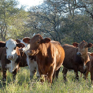
The Dry Chaco vegetation is characterized by forests with xeromorphic features in response of the dry climate conditions. Height and structural complexity follow a decreasing E-W precipitation gradient. Originally, the landscape of this region was a tall forest in which trees and shrubs of “Quebrachos”, belonging to the genera Schinopsis and Aspidosperma. These trees, because of their high economic value, have started to be exploited for more than one century ago. Nowadays, the forest degradation is linked to the charcoal production, to grazing pressures and to selective logging. In more degraded forests, theoretic evidence from forestry science and from empirical studies of the region, show that in more degraded forests, less abundant and pioneers species will tend to increase. Structurally, we will find that the shrub layer will increase its basal area. A degraded forest will be characterized by a very dense cover of thin stems up to 2 meter high, with few trees.

Figure 2: Conceptual scheme of the degradation pathways related to different land use practices. Extensive grazing, selective logging of valuable species, wood extraction for charcoal production and fires lead to the development of secondary forest and scrubs. Herbicide spraying from airplanes, a common practice in soybean cropping, might affect the surrounding forest as well.
The Dry Chaco vegetation is characterized by forests adapted to water stress conditions in response to the dry climate conditions. Height and structural complexity follow a decreasing E-W precipitation gradient. Originally, the landscape of this region was a tall forest in which trees and shrubs of “Quebrachos”, belonging to the genera Schinopsis and Aspidosperma. These trees, because of their high economic value, have started to be exploited for more than one century ago. Nowadays, the forest degradation is linked to the selective logging, to grazing pressures, fires and herbicide spraying from the closer fields (Figure 2). In more degraded forests, theoretical evidence from forestry science and empirical studies, show that pioneer species will tend to increase. Structurally, we will find that the shrub layer will increase its basal area. A degraded forest will then be characterized by a very dense cover of thin stems up to 2 meter high, with few tall trees.
Methods and results
a. Remote sensing methods for forest degradation assessment
- Structure-from-motion with drone imagery to characterize forest structure:
Structure from motion is an algorithm applying stereoscopic methods to a set of pictures to reconstruct the three-dimensional pattern of objects. We applied this methods to selected areas of the Argentinean Dry Chaco. The final products are the point cloud of the vegetation structure and the canopy height model. From these products we are able to characterize different structural attributes of the forest and to describe the degradation state of the forest (Figure 3).
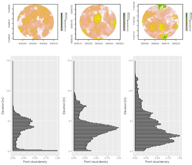
Figure 3: Canopy height model and point cloud of three forest plots representing different degradation states.
- Landsat time series analysis for disturbance detection
Landsat imagery provides spatially and temporally continuous data, at a resolution (30m) suited to study forest cover changes. We combined temporal segmentation analysis of an ensemble of Landsat times series with a Random Forest classifier to identify patterns of forest disturbances leading to forest degradation.

Figure 4: We use metrics derived from the temporal segmentation of Landsat time-series to characterize disturbances
b. Land surface models and soil salinization
Deforestation and forest degradation in the Chaco are also causing soil degradation problems. In many places, soil moisture and soil salinity increase sharply after deforestation. To improve our understanding of deforestation and forest degradation on soil hydrology and -salinity, land surface models and remote sensing data are combined. More specifically, default climatological vegetation parameters (LAI, NDVI, greenness) in state-of-the-art land surface models (LSM) are updated by satellite-based dynamic vegetation data to feed the models with deforestation and forest degradation. The hydrological output from these models are used together with in-situ salinity measurements to better understand the link between forest degradation and soil salinization.

Figure 5: Forest degradation maps are implemented in Land Surface Models to assess the hydrological impact of vegetation changes. Next, the improved simulations are used to better understand how soil salinization may degrade soils when vegetation is disturbed.
Field Trips
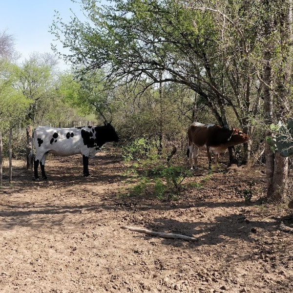
2017 - 2018: Drones flights and forest-inventory
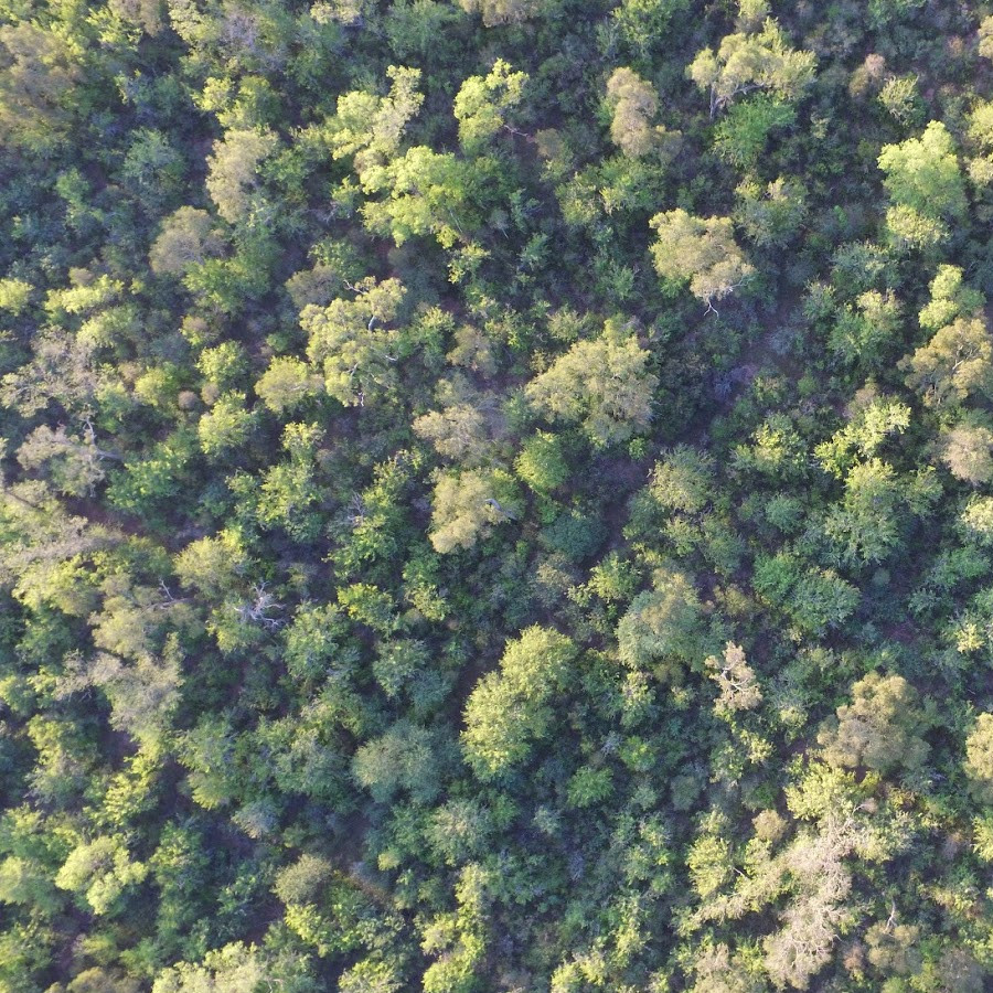
During the summer of 2017 and 2018, we went to the field with the ReForCha research team. With the scientist of the Instituto de Ecologia Regional, we revisited multiple permanent forest plots. The forest inventory was coupled with image acquisition using a customer-grade UAV. We used maps developed by M. Baumann on the fraction of the area covered by trees with DBH > 15cm as a predictor variable of the structural pattern of the forest.
The UAV-imagery is now used to reconstruct canopy height models and to study forest structure and degradation in the area.

Figure 5: UAV-Drone field trip, drone launching in Dry forests.
2019: Collection soil moisture and soil salinity-data
During the summer 2019 field campaign, soil samples were taken across the central part of the Dry Chaco. Measurements of soil moisture and electronic conductivity (indicator for soil salinity) were collected over a wide range of elevation, climate, vegetation and land use. Measurements were taken at 5cm, 20 cm, 1m and at certain locations up to 2m. In addition, also a detailed sampling strategy was conducted, focussing on adjacent forested and deforested areas to study the potential impact of deforestation and forest degradation on soil salinity.

Figure 6: (a) Researchers involved in the ReForCha project are taking soil moisture and salinity measurements to better assess the link between deforestation and soil salinization. (b) Heavily degraded soil due to soil salinization.
Funding
Funding for this research has been provided by the Belgian Science Policy Office (BELSPO) grant ReForCha, for « Continuous satellite-based indicators for mapping subtropical forest degradation and its environmental impacts ».
 http://www.belspo.be
Publications
The first publication from the ReForCha has been published the 7th of December 2020:
Title: Comparing Forest Structural Attributes Derived from UAV-Based Point Clouds with Conventional Forest Inventories in the Dry Chaco.
Abstract: Anthropogenic activity leading to forest structural and functional changes needs specific ecological indicators and monitoring techniques. Since decades, forest structure, composition, biomass and functioning have been studied with ground-based forest inventories. Nowadays, satellites survey the earth, producing imagery at different spatial and temporal resolutions. However, measuring the ecological state of large extensions of forest is still challenging. In this study, we implement the technological package UAV-SfM, applying structure from motion (SfM) algorithms to unmanned aerial vehicle (UAV) imagery, to reconstruct the three-dimensional forest structure. Structural indicators from UAV-SfM products are then compared to forest inventory indicators of 64 circular plots of 1000 m² in a subtropical dry forest. Our data indicate that the UAV-SfM indicators provide a valuable alternative for ground-based forest inventory’ indicators of the upper canopy structure. Based on the correlation between ground-based measures and UAV-SfM derived indicators, we can state that the UAV-SfM technique provides reliable estimates of the mean and maximum height of the upper canopy. The performance of UAV-SfM techniques to characterize the undergrowth forest structure is low, as UAV-SfM indicators derived from the point cloud in the lower forest strata are not suited to provide correct estimates of the vegetation density in the lower strata. Besides structural information, UAV-SfM derived indicators, such as canopy cover, can provide relevant ecological information as the indicators are related to structural, functional and/or compositional aspects, such as biomass or compositional dominance. Although UAV-SfM techniques cannot replace the wealth of data collected during ground-based forest inventories, its strength lies in the 3D monitoring of the tree canopy at cm-scale resolution, and the versatility of the technique to provide multi-temporal datasets of the horizontal and vertical forest structure.

Gobbi, B.; Van Rompaey, A.; Loto, D.; Gasparri, I.; Vanacker, V. Comparing Forest Structural Attributes Derived from UAV-Based Point Clouds with Conventional Forest Inventories in the Dry Chaco. Remote Sens. 2020, 12, 4005
Partners
Veerle Vanacker
veerle.vanacker@uclouvain.be
Université catholique de Louvain
Eric Lambin
eric.lambin@uclouvain.be
Université catholique de Louvain
Anton Van Rompaey
anton.vanrompaey@ees.kuleuven.be
KU Leuven
Gabriëlle De Lannoy,
gabrielle.delannoy@kuleuven.be
KULeuven
Tobias Kuemmerle
tobias.kuemmerle@geo.hu-berlin.de
Humboldt-University Berlin
Nestor Ignacio Gasparri
ignacio.gasparri@gmail.com
National University of Tucuman