


1.2.2 General circulation of the atmosphere
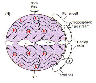
The high temperatures at the equator make the air there less dense. It thus tends to rise before being transported poleward at high altitudes in the troposphere. This motion is compensated for at the surface by an equatorward displacement of the air. On a motionless Earth, this big convection cell would reach the poles, inducing direct exchanges between the warmest and coldest places on Earth. However, because of the Earth's rotation, such an atmospheric structure would be unstable. Consequently, the two cells driven by the ascendance at the Equator, called the Hadley cells, close with a downward branch at a latitude of about 30o (Fig. 1.4). The northern boundary of these cells is marked by strong westerly winds in the upper troposphere called the tropospheric jets. At the surface, the Earth's rotation is responsible for a deflection toward the right in the northern hemisphere and toward the left in the southern hemisphere (due to the Coriolis force) of the flow coming from the mid-latitudes to the Equator. This gives rise to the easterly trade winds characteristics of the tropical regions (Fig. 1.5).
|
The extratropical circulation is dominated at the surface by westerly winds whose zonal symmetry is perturbed by large wave-like patterns and the continuous succession of disturbances that governs the day-to-day variations in the weather in these regions. The dominant feature of the meridional circulation at those latitudes is the Ferrell cell (Fig. 1.4), which is weaker than the Hadley cell. As it is characterized by rising motion in its poleward branch and downward motion in the equator branch, it is termed an indirect cell by contrast with the Hadley cell, which is termed a direct cell.
|
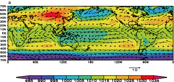
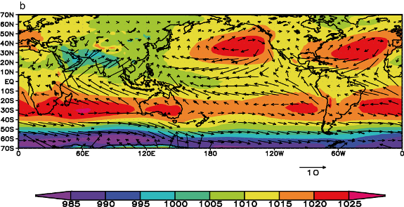
Outside a narrow equatorial band and above the surface boundary layer, the large-scale atmospheric circulation is close to geostrophic equilibrium. The surface pressure and winds are thus closely related. In the Northern Hemisphere, the winds rotate clockwise around a high pressure and conterclockwise around a low pressure, while the reverse is true in the Southern Hemisphere. Consequently, the mid-latitude westerlies are associated with high pressure in the subtropics and low pressure at around 50-60o. Rather than a continuous structure, this subtropical high pressure belt is characterised by distinct high pressure centres, often referred to as the name of a region close to their maximum (e.g., Azores high, St Helena high). In the Northern Hemisphere, the low pressures at around 50-60oN manifest themselves on climatological maps as cyclonic centres called the Icelandic low and the Aleutian low. In the Southern Ocean, because of the absence of large land masses in the corresponding band of latitude, the pressure is more zonally homogenous, with a minimum in surface pressure around 60o S.
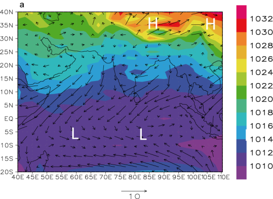
In the real atmosphere, the convergence of surface winds and the resulting ascendance does not occur exactly at the equator but in a band called the Intertropical Convergence Zone (ITCZ). Because of the present geometry of the continents, it is located around 5o N, with some seasonal shifts. The presence of land surfaces also has a critical role in monsoon circulation. In summer, the continents warm faster than the oceans because of their lower thermal inertia (see section 2.1.5). This induces a warming of the air close to the surface and a decrease in surface pressure there. This pressure difference between land and sea induces a transport of moist air from the sea to the land. In winter, the situation reverses, with high pressure over the cold continent and a flow generally from land to sea. Such a mosoonal circulation, with seasonal reversals of the wind direction, is present in many tropical areas of Africa, Asia and Australia. Nevertheless, the most famous monsoon is probably the South Asian one that strongly affects the Indian sub-continent (Fig. 1.6)
 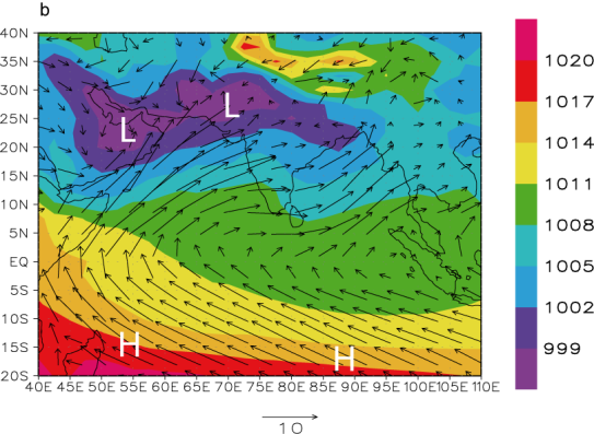
|